
What's New for the WNHP
The WNHP Data Explorer is now available
We have created our new Washington Natural Heritage Program (WNHP) Data Explorer online Geographic Information System (GIS) application (see the User Guide). The Data Explorer replaces the WA Wetlands of High Conservation Value (WHCV) map viewer. Whereas the WHCV viewer primarily displayed wetland-associated rare species and ecosystems, the Data Explorer shares:
- All publicly-available locations of rare species and rare & high-quality ecosystems, known as Element Occurrences (EOs), currently documented in WNHP’s database, with precise species boundaries masked to protect sensitive species locations; and
- WNHP’s available Level 1 and Level 2 Ecological Integrity Assessment (EIA) data.
Other datasets are also accessible in the Data Explorer to help guide land use decisions, inform natural resource management, and prioritize conservation actions. WNHP will continue to improve and expand the application into the future.
Study of land use impacts on Sphagnum-dominated peatlands
WNHP ecologists, in collaboration with colleagues from Colorado State University and University of Oregon, completed a study of land use impacts on Sphagnum-dominated peatlands (locally called bogs) in the Puget Lowland ecoregion. This research demonstrated that increasing impervious surface area around these bogs has a negative effect on their hydrology, water chemistry, and vegetation patterns. The research also tested the efficacy of multiple rapid, ecological assessment tools in tracking these changes. The report provides recommendations for improved regulation, management, and conservation of these sensitive peatlands. This report and appendices can be found on our Ecosystems Technical Reports page, under the Wetlands and Riparian Areas section.
Updated Manuals for Conducting Ecological Integrity Assessments
WNHP ecologists have published updated manuals for conducting Ecological Integrity Assessments, incorporating revisions made during the 2022 field season. These updates clarify and expand the application of both wetland (version 1.3) and upland (version 1.4) EIAs. The EIA manuals are available for download on the Ecological Integrity Assessment page and the Ecosystems Technical Reports page.
Ecological Integrity Assessments in the Puget Sound Region
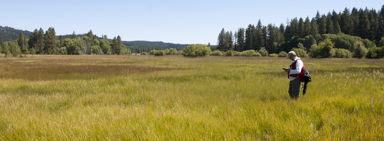
WNHP ecologists recently completed Level 1 and Level 2 EIAs within the Puget Sound drainage basin aimed to improve the knowledge and data accessibility of the locations of ecologically important lands, identify and prioritize areas for restoration and protection, and enable land managers to assess current ecological conditions and monitor restoration progress. To these ends, we began by developing a Level 1 EIA to assess current ecological condition of undeveloped areas in the Puget Sound drainage basin using remote sensing data. Level 2 field EIAs (rapid, field-based assessments) were conducted in the Puyallup-White Water Resource Inventory Area (WRIA 10). Level 2 field assessments helped to refine priority areas for restoration and protection through the identification of new EOs and to refine and adjust rank thresholds in the Level 1 model. Together, these EOs and EIA data support local government planners by highlighting the locations of these ecologically important lands in the Puget Sound drainage basin, while the EIA methodology may continue to be deployed to track changes in integrity over time. This project was completed with funding from Puget Sound National Estuary Program. This report and others can be found on our Ecosystems Technical Reports page. You can also view the report here.
Ecological Integrity Assessment Online Training
An online Ecological Integrity Assessment (EIA) training formerly presented by Natural Heritage Program staff has been modified into a self-guided online training module. This is a great place to start if you are interested in learning more about EIA methodology and applications. See the EIA Online Training heading on our Ecological Integrity Assessment page.
The 2022 State of Washington Natural Heritage Plan
The State of Washington Natural Heritage Plan establishes a list of priority species and ecosystems and describes the criteria and process by which sites are selected for addition to the statewide system of natural areas. The 2022 edition of the Plan implements new approaches to address new threats to biodiversity, helping DNR and our partners to focus our efforts on the flora and fauna that most need conservation. The Plan and associated appendices are found on our Conservation Planning page.
55 Additional Climate Change Vulnerability Index reports
WNHP botanist Walter Fertig recently completed 55 additional assessments for state endangered, threatened, and sensitive vascular plants using the Climate Change Vulnerability Index (CCVI) developed by NatureServe. The CCVI is a standardized tool for ranking the vulnerability of plant or animal species to projected climate change based on their inherent sensitivity and capacity to adapt to shifting temperature and precipitation patterns. This is Phase 2 of a project funded by the US Forest Service Region 6. You can read the full report here. The individual CCVIs can be accessed from the table on our Assessing Species Vulnerability page.
WA Rare Plant Field Guide update
The WA Rare Plant Field Guide has been updated with funding from the U.S. Fish and Wildlife Service. The initial online version consisted of links to individual species treatments in the form of PDFs, which were a challenge to update. Our newest version is based on a platform, created by the Montana Natural Heritage Program, which is easily edited and allows us to present up-to-date information. The guide now includes treatments for 371 vascular plants, 6 bryophytes, and 1 lichen.
Updated versions of the WA Vascular Plant Species of Special Concern List and the Vascular Review Group 1 and 2 List
An updated version of the WA Natural Heritage Program state list of vascular plant species of conservation concern is now available on the Species Lists page. The 2021 list includes revised information on the state status and distribution of 371 Endangered, Threatened, and Sensitive plant species in Washington. For the first time, the list also includes information on ecological systems (vegetation types) where these species are known to occur. The companion list of review species (plant taxa being considered for future designation as state Endangered, Threatened, or Sensitive) has also been revised.
Report on the conservation status of whitebark pine in Washington
Whitebark pine (Pinus abicaulis) is a widespread tree species found mostly at alpine treeline or upper subalpine forests in the higher mountains of northwestern North America, from British Columbia and Alberta south to California, Nevada, and Wyoming. In Washington, it occurs in the Olympic and Cascades ranges and higher peaks of the Okanogan Plateau and Rocky Mountains in the northeast corner of the state. Across its range, whitebark pine has declined by more than 50% due to mortality from introduced white pine blister rust, outbreaks of mountain pine beetles, increased temperatures and decreased snowpack due to climate change, and increased wildfire. In December, 2020, the US Fish and Wildlife Service (USFWS) proposed listing whitebark pine as a Threatened species under the US Endangered Species Act.
As part of a Section 6 agreement between USFWS and the Washington Natural Heritage Program (WNHP), we recently completed a report on the conservation status of whitebark pine in Washington using ranking procedures developed by NatureServe (the umbrella network of natural heritage programs). The report includes a potential habitat model derived from US Forest Service, WA Department of Natural Resources, and National Park Service vegetation plots and various environmental predictor variables (geology & soils, topography, climate). We used the model to identify 10 primary population centers (potential element occurrences) of whitebark pine in Washington and to extrapolate population numbers and area of occupancy. Presence and absence data used to construct the model are housed in WNHP’s GIS-based observation database. Whitebark pine is now listed as a state Sensitive plant species in Washington (with rank of G3G4/S3). The full report can be found here.
Crowberry Bog research recently published
Our Crowberry Bog research was recently published in the journal Ecohydrology. Our article “Ecohydrological characteristics of a newly identified coastal raised bog on the western Olympic Peninsula, Washington State, USA” can be accessed here.
Revised vegetation classification for Mount Rainier, Olympic, and North Cascades National Parks
Tynan Ramm-Granberg and Joe Rocchio recently published a revised vegetation classification for Mount Rainier, Olympic, and North Cascades National Parks as part of a long-term partnership with the National Park Service (NPS). The classification draws on over 10 years of vegetation mapping data collected by NPS field crews, as well as decades of regional classification efforts by ecologists at WNHP, the US Forest Service, and elsewhere. Analyses provided support for most of the provisional plant associations in Crawford et al. (2009), while also revealing previously undescribed vegetation types that were not represented in the United States National Vegetation Classification (USNVC). Both provisional and undescribed types have since been submitted to the USNVC by WNHP staff through a peer-reviewed process. In addition to the summary report, revised keys and descriptions, environmental data, and synoptic/constancy tables are available.
Updates to the field manuals for applying rapid Ecological Integrity Assessments
Joe Rocchio and Tynan Ramm-Granberg recently published updated manuals for conducting Ecological Integrity Assessments, incorporating revisions from 5+ field seasons of vetting in upland and wetland ecosystems across Washington. These manuals provide a standardized method for rapidly assessing ecosystem condition across the diverse landscapes of our state. Methods and metrics were developed in collaboration with NatureServe and funded by U.S Environmental Protection Agency, Region 10 Wetland Development grants, along with support from Columbia Land Trust and the Washington Department of Natural Resources. The EIA manuals are available for download here.
47 additional Climate Change Vulnerability Index reports
WNHP botanist Walter Fertig recently completed an assessment of 47 vascular plant species identified as state endangered, threatened, or sensitive using the Climate Change Vulnerability Index (CCVI) developed by NatureServe. The CCVI is a standardized tool for ranking the vulnerability of plant or animal species to projected climate change based on their inherent sensitivity and capacity to adapt to shifting temperature and precipitation patterns. Each CCVI takes into account 29 indicators related to habitat specificity, dispersal ability, competition, pollination biology, and genetic diversity. The CCVI scores can be used to identify and prioritize species that are most are risk of extirpation due to climate change and help resource managers develop adaptation and mitigation strategies. The report was funded by the US Forest Service Region 6. You can read the full report here. The individual CCVIs can be accessed from the table on our Assessing Species Vulnerability page.
