
Virtual Legislative Tours
Take a Virtual Tour of DNR
We recently created virtual tours that explore issues specific to the agency's six regions. These tours were presented to state lawmakers and have been made available below.

The Eastside, Wildfire, and Forest Health
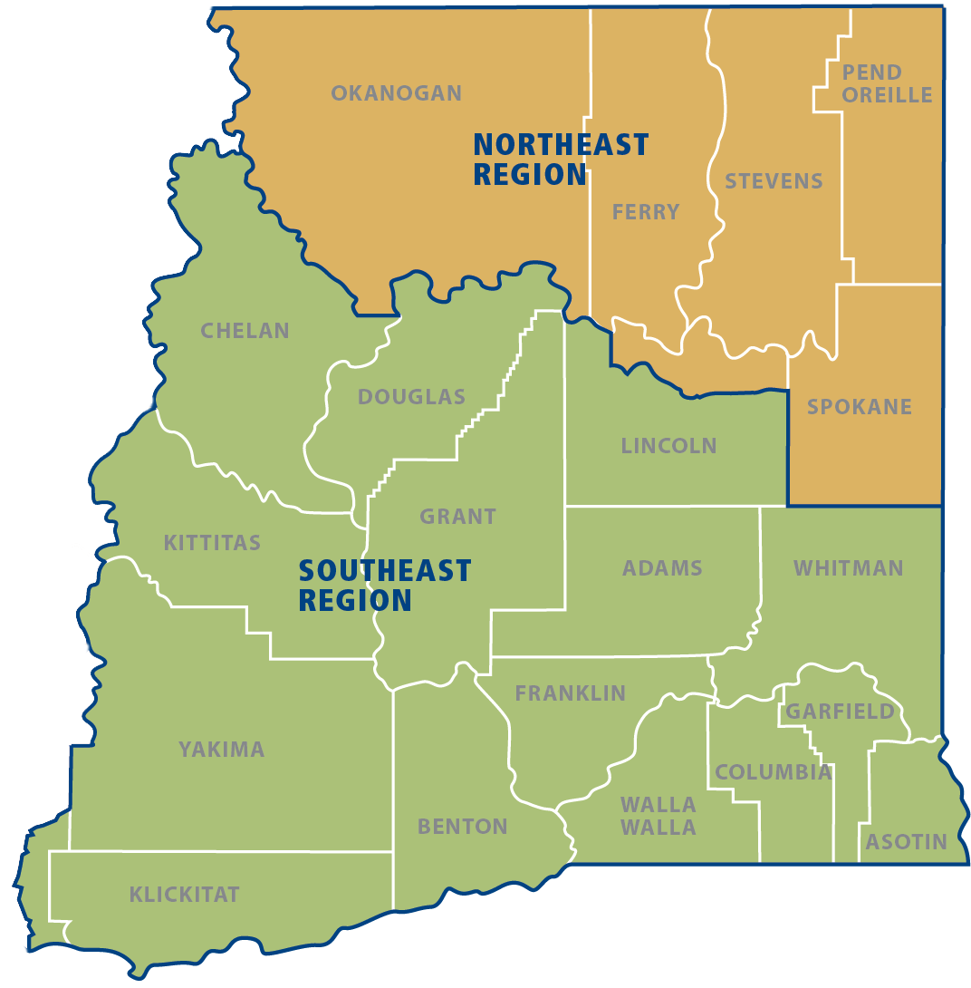
Forest health, wildfire risk, and rural economic development are inextricably linked in central and eastern Washington. This virtual tour of DNR's Northeast and Southeast regions includes information about the 2020 wildfire season, effects of fires past, region-specific examples of successful forest health treatments, and an outline of the challenges the communities in these regions face moving forward.
Northwest Region
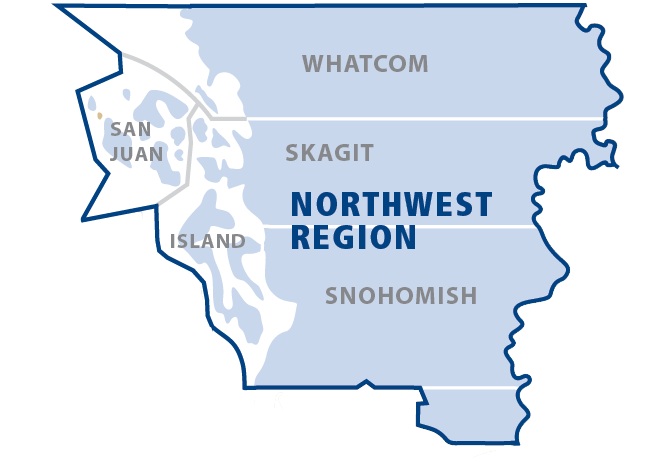
From Snohomish County to the San Juan Islands, DNR’s Northwest Region features a rich array of programs that serve residents, community institutions, and the land itself. Take this tour to get an overview of how DNR manages state-owned uplands and aquatic lands, ensures forest practices are managed effectively and sustainably, and studies and shares knowledge about the area's geology.
Olympic Region
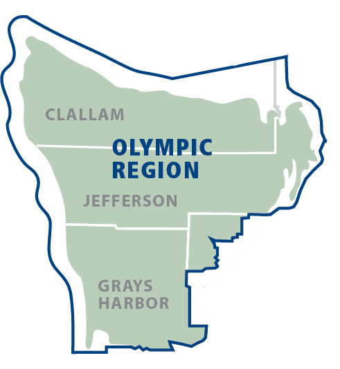
DNR’s Olympic Region is situated in some of the most remote, productive and scenic landscapes in North America. This tour provides an overview of how DNR serves residents, communities and land itself through its State Lands, Forest Practices, Geology, and Aquatics divisions.
Pacific Cascade Region
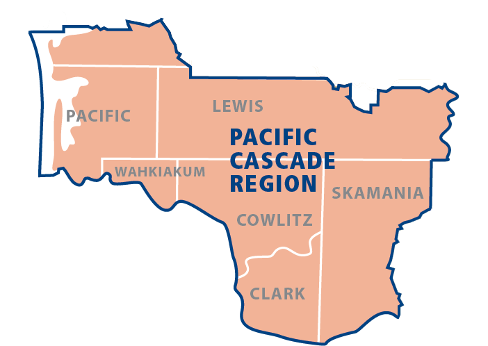
From Skamania to Pacific County, DNR’s Pacific Cascade Region covers some of the most productive forests, farms and tidelands in the world. This tour will take you through DNR's management of state-owned forests and aquatic lands, precious conservation areas, rich recreational opportunities and stunning geology.
State Lands and the Southeast Region
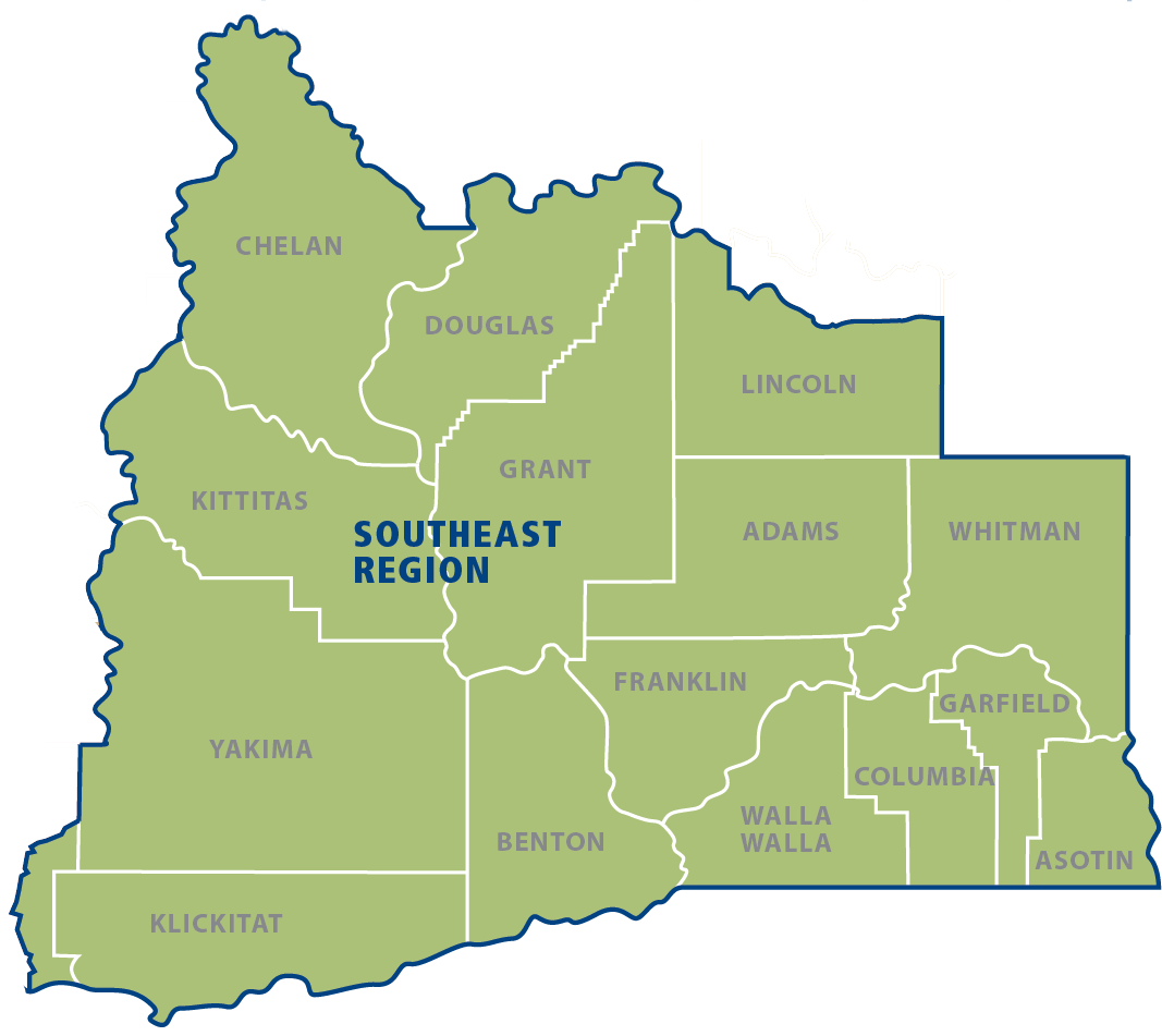
With a vast and varied landscape that covers the verdant Columbia River Gorge, the rugged Columbia Plateau and the rich rolling hills of the Palouse, southeast Washington features some of the state's most productive working lands. This tour will walk you through the public benefits provided by DNR's management of state-owned lands. The virtual itinerary includes examples of recreation and working forestry, target shooting, silviculture, forest roads, communications sites, commercial leasing, and natural areas specific to the Southeast Region.
South Puget Sound Region
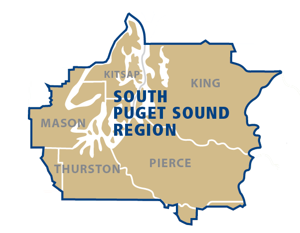
From the remote forests of the Kitsap Peninsula to downtown Seattle, DNR’s South Puget Region provides a vast playground for Washington's most populous region as part of the agency's diverse portfolio of state-owned forests, tidelands and commercial holdings. This tour provides a look at how DNR's State Lands, Forest Practices, Geology, and Aquatics divisions benefit the people of Washington.
