
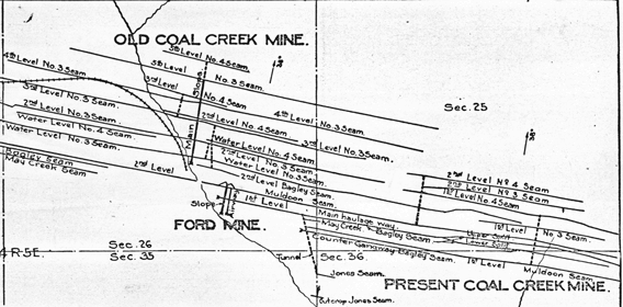
Coal mine map of the Coal Creek Mine
About 1,100 individual maps representing about 230 mines comprise the Washington State coal mine map collection, which is held at the Washington Geological Survey. The maps are an invaluable source of information for mine subsidence hazard evaluation and mitigation, structural geology, coal exploration, resource evaluation, and historical research.
A catalog, index, and user's guide for the collection has been published by the Washington Geological Survey as Open File Report 94-7.
Coal mine maps are organized by county and packaged into 65 zip files, each of 200 MB or less. Map titles are derived from the index numbers used in the catalog (Open File Report 94-7). Use the catalog to determine which maps are of interest. The alphanumeric map index number begins with an alphabetic abbreviation for the county, followed by a numeric mine identifier and an alphabetic map identifier. For example, the index number K59_C identifies the third map in a series, for the 59th mine listed in King County in the map catalog.
The coal mine map collection is on the portal!
|
|
The coal mine map collection data set includes historical mine locations and scanned maps. The mine location points provide links to non-georeferenced maps. Georeferenced map extents are provided as a separate layer. |
